
1934 Map of Springfield
USGS Topo · Published 1934About this map
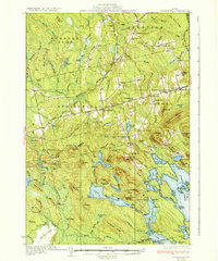
Springfield and the neighboring townships of Prentiss and Carroll reveal a traditional Maine landscape defined by timber, small-scale farming, and the waterways of the Penobscot and Hancock county border. The area is anchored by the Passadumkeag River and the expansive waters of Sysladobsis Lake and Lombard Lake. Rural education is a visible priority across the terrain, evidenced by numerous named schoolhouses such as Webster Sch, Cole Sch, and Gowell Sch serving these scattered communities. Settlement patterns follow the ridges and rivers, with landmarks like the Fire Tower on Dill Ridge and distinct agricultural sites such as Bridge Farm and Carry Farm indicating the local economy of the 1930s. The network of roads, including Route 170, connects these remote hamlets through a complex series of glaciated features like Kirkland Ridge and the broad 1000 Acre Heath.
Find a feature on this map
114 named features on this map. Tap any name to fly to it.
Don’t see what you’re looking for? This feature index may not catch every label — zoom into the map to look around manually.
Map Details
Editions of this 1934 Springfield Map
4 editions found
Other maps of this area

1920 · Winn
USGS Topo · 1:62,500

1931 · Springfield
USGS Topo · 1:48,000

1931 · Saponac
USGS Topo · 1:48,000

1932 · Nicatous Lake
USGS Topo · 1:48,000

1934 · Saponac
USGS Topo · 1:62,500

1934 · Nicatous Lake
USGS Topo · 1:62,500

1940 · Danforth
USGS Topo · 1:62,500

1940 · Mattawamkeag
USGS Topo · 1:62,500

1941 · Danforth
USGS Topo · 1:62,500

1941 · Scraggly Lake
USGS Topo · 1:62,500