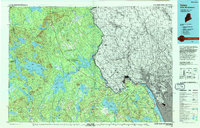
1994 Map of Calais
USGS Topo · Published 1994About this map
The border communities of Calais and Milltown anchor the eastern edge of this Maine-New Brunswick study, situated where the river network meets the Atlantic influence. This mid-1990s composite reveals a landscape defined by an extensive system of interconnected waterways, including Big Lake, Baskahegan Lake, and Grand Lake, which historically facilitated the region's timber and industrial economy. The mapping shows the Passamaquoddy Indian Reservation situated near Princeton, highlighting the long-standing indigenous presence in the St. Croix watershed. Conservation and land management are prominent, with the Moosehorn National Wildlife Refuge protecting significant acreage south of the industrial center at Woodland. Small interior settlements like Grand Lake Stream and Cooper are shown connected by a winding road network through the timberlands, while coastal sites like Red Beach and Robbinston line the river's path toward the sea.
Find a feature on this map
86 named features on this map. Tap any name to fly to it.
Don’t see what you’re looking for? This feature index may not catch every label — zoom into the map to look around manually.
Map Details
Editions of this 1994 Calais Map
This is the sole edition of this map. No revisions or reprints were ever made.
Other maps of this area

1907 · Eastport
USGS Topo · 1:48,000

1908 · Eastport
USGS Topo · 1:62,500

1929 · Calais
USGS Topo · 1:48,000

1929 · Robbinston
USGS Topo · 1:48,000

1929 · Lead Mountain
USGS Topo · 1:48,000

1930 · Vanceboro
USGS Topo · 1:48,000

1931 · Springfield
USGS Topo · 1:48,000

1931 · Robbinston
USGS Topo · 1:62,500

1932 · Calais
USGS Topo · 1:62,500

1932 · Nicatous Lake
USGS Topo · 1:48,000