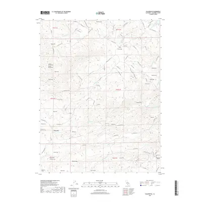
2018 Map of Calaveritas
USGS Topo · Published 2018About this map
Calaveritas and the surrounding gold-country landscape are defined by a complex network of waterways and winding roads that reveal the area's deep connection to California's historic mining and ranching economy. The settlement of Cave City and the area of Old Gulch serve as anchors in a terrain characterized by numerous named gulches, including Mexican Gulch and French Gulch. Water management is evident through features like the Fricot Ditch, which traverses the hills alongside natural flows like Calaveritas Cr and San Antonio Cr. The map captures a transition from industrial activity to more modern residential patterns, with local names like Lucky Jim Mine Rd and Cement Plant Rd providing clues to the previous land use. Higher elevations such as Quiggs Mtn and High Mtn overlook the intricate drainage basins that include the Salamander Cr and Indian Cr systems.
Find a feature on this map
102 named features on this map. Tap any name to fly to it.
Don’t see what you’re looking for? This feature index may not catch every label — zoom into the map to look around manually.
Map Details
Editions of this 2018 Calaveritas Map
This is the sole edition of this map. No revisions or reprints were ever made.
Other maps of this area

1889 · Jackson
USGS Topo · 1:125,000

1891 · Big Trees
USGS Topo · 1:125,000

1892 · Jackson
USGS Topo · 1:125,000

1894 · Big Trees
USGS Topo · 1:125,000

1897 · Jackson
USGS Topo · 1:125,000

1897 · Big Trees
USGS Topo · 1:125,000

1901 · Big Trees
USGS Topo · 1:125,000

1902 · Jackson
USGS Topo · 1:125,000

1945 · San Andreas
USGS Topo · 1:62,500

1947 · San Andreas
USGS Topo · 1:62,500