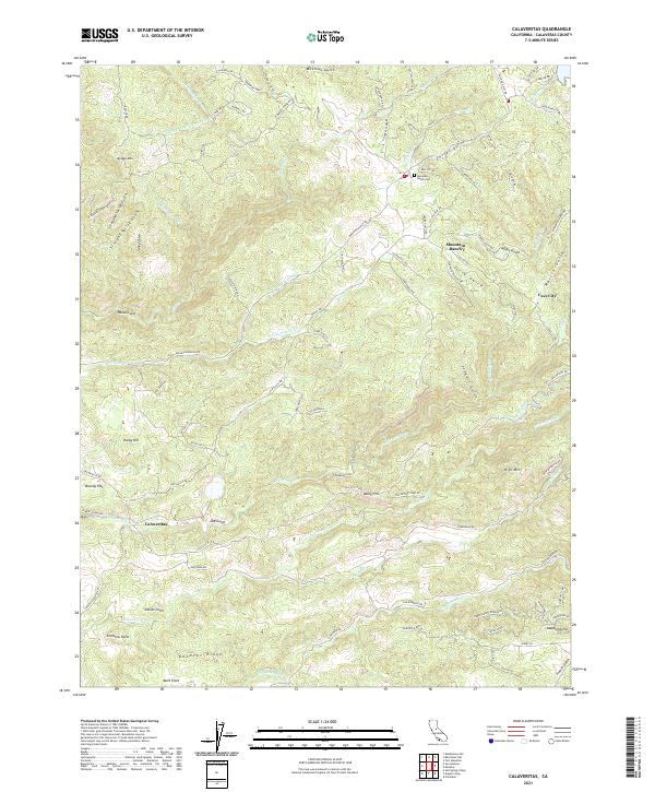
2021 Map of Calaveritas
USGS Topo · Published 2021About this map
Mountain Ranch and the historic settlement of Calaveritas anchor this modern survey of the California gold country landscape. The terrain is defined by a dense network of gulches and ridges, including Mexican Gulch, Dirty Gulch, and Donovan Ridge, reflecting a complex topography long shaped by water and mining. The map documents the enduring infrastructure of the region, from the Fricot Ditch to the Lucky Jim Mine Rd, while also locating local landmarks like the Mountain Ranch Cem and the small communities at Old Gulch and Cave City.
Find a feature on this map
100 named features on this map. Tap any name to fly to it.
Don’t see what you’re looking for? This feature index may not catch every label — zoom into the map to look around manually.
Map Details
Editions of this 2021 Calaveritas Map
This is the sole edition of this map. No revisions or reprints were ever made.
Other maps of this area

1889 · Jackson
USGS Topo · 1:125,000

1891 · Big Trees
USGS Topo · 1:125,000

1892 · Jackson
USGS Topo · 1:125,000

1894 · Big Trees
USGS Topo · 1:125,000

1897 · Jackson
USGS Topo · 1:125,000

1897 · Big Trees
USGS Topo · 1:125,000

1901 · Big Trees
USGS Topo · 1:125,000

1902 · Jackson
USGS Topo · 1:125,000

1945 · San Andreas
USGS Topo · 1:62,500

1947 · San Andreas
USGS Topo · 1:62,500