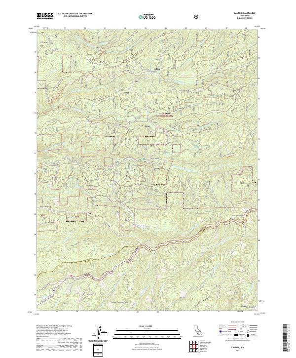
2021 Map of Caldor
USGS Topo · Published 2021About this map
Eldorado National Forest defines the mountainous landscape of this region, where the steep canyons of the Middle Fork Cosumnes River and the South Fork Cosumnes River converge near the El Dorado and Amador County line. The terrain is marked by prominent ridges like Plummer Ridge and Gold Note Ridge, with small clearings and settlements such as Caldor and Elkins Flat serving as remote outposts. These areas are connected by a network of specialized routes, including the Caldor Logging Rd and trails that reference the region’s industrial history, such as the Myers R.R. Trl.
Find a feature on this map
67 named features on this map. Tap any name to fly to it.
Don’t see what you’re looking for? This feature index may not catch every label — zoom into the map to look around manually.
Map Details
Editions of this 2021 Caldor Map
This is the sole edition of this map. No revisions or reprints were ever made.
Other maps of this area

1889 · Jackson
USGS Topo · 1:125,000

1889 · Pyramid Peak
USGS Topo · 1:125,000

1891 · Big Trees
USGS Topo · 1:125,000

1891 · Placerville
USGS Topo · 1:125,000

1891 · Pyramid Peak
USGS Topo · 1:125,000

1892 · Jackson
USGS Topo · 1:125,000

1892 · Placerville
USGS Topo · 1:125,000

1893 · Placerville
USGS Topo · 1:125,000

1894 · Big Trees
USGS Topo · 1:125,000

1895 · Pyramid Peak
USGS Topo · 1:125,000