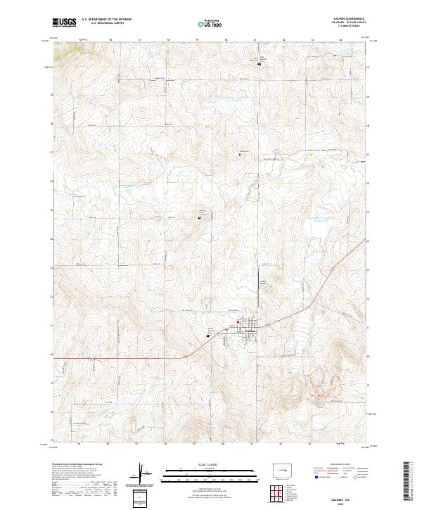
2022 Map of Calhan
USGS Topo · Published 2022About this map
Calhan serves as the focal point of this high plains landscape, situated within a network of section-line roads and rolling topography. The area is notable for its numerous burial grounds, reflecting the diverse heritage of the early community, including the National Slovak Society Cem, Saint Michaels Cem, and Saint Mary's Cem. These sites, along with the Calhan Memorial Cem, are distributed along the ridges and plateaus that separate the local drainage basins. The southern portion of the quadrangle reveals a unique geological and recreational character near the Paint Mines North Trl and Paint Mines South Trl, where the land drops into the colorful formations of the Paint Mine Rd area. This landscape, shaped by the Big Sandy Cr and Holcolm Hills, demonstrates a long history of cattle ranching and early mining, evidenced by the presence of the Apach Mine.
Find a feature on this map
36 named features on this map. Tap any name to fly to it.
Don’t see what you’re looking for? This feature index may not catch every label — zoom into the map to look around manually.
Map Details
Editions of this 2022 Calhan Map
This is the sole edition of this map. No revisions or reprints were ever made.
Other maps of this area

1893 · Big Springs
USGS Topo · 1:125,000

1953 · Denver
USGS Topo · 1:250,000
1954 · Haegler Ranch
USGS Topo · 1:24,000

1954 · Pueblo
USGS Topo · 1:250,000

1957 · Denver
USGS Topo · 1:250,000

1957 · Pueblo
USGS Topo · 1:250,000

1958 · Pueblo
USGS Topo · 1:250,000

1958 · Denver
USGS Topo · 1:250,000

1960 · Denver
USGS Topo · 1:250,000

1962 · Pueblo
USGS Topo · 1:250,000