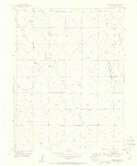
1954 Map of Haegler Ranch
USGS Topo · Published 1955About this map
Haegler Ranch and its neighboring agricultural homesteads define the mid-century landscape of this high-plains portion of eastern El Paso County. Surveyed in 1954, the map reveals a land organized by large landholdings and essential water resources, such as the numerous windmills and Spring points that supported the cattle operations. The presence of the Community Building along the Falcon Highway serves as a reminder of the social hubs that unified this rural ranching society.
Find a feature on this map
16 named features on this map. Tap any name to fly to it.
Don’t see what you’re looking for? This feature index may not catch every label — zoom into the map to look around manually.
Map Details
Editions of this 1954 Haegler Ranch Map
3 editions found
Other maps of this area

1893 · Big Springs
USGS Topo · 1:125,000

1893 · Colorado Springs
USGS Topo · 1:125,000

1894 · Castle Rock
USGS Topo · 1:125,000

1909 · Colorado Springs
USGS Topo · 1:125,000

1913 · Castle Rock
USGS Topo · 1:125,000

1940 · Elbert
USGS Topo · 1:62,500

1942 · Colorado Springs
USGS Topo · 1:125,000

1944 · Elbert
USGS Topo · 1:62,500

1948 · Falcon
USGS Topo · 1:24,000

1948 · Falcon
USGS Topo · 1:62,500