
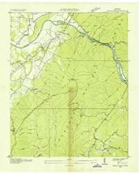
1935 Map of Calhoun
USGS Topo · Published 1935About this map
The Hiwassee River winds through this landscape on the border of McMinn and Bradley counties, reflecting a mid-1930s era of rural Tennessee infrastructure and agriculture. The Southern Railway and the Lee Highway run parallel through the western corridor, serving as the primary arteries for the settlements of Sanford and Calhoun. The landscape is defined by the prominent Getty Ridge and Red Hills, which separate numerous small drainage systems like Oostanaula Creek and Chestuee Creek.
Find a feature on this map
48 named features on this map. Tap any name to fly to it.
Don’t see what you’re looking for? This feature index may not catch every label — zoom into the map to look around manually.
Map Details
Editions of this 1935 Calhoun Map
This is the sole edition of this map. No revisions or reprints were ever made.
Other maps of this area

1886 · Cleveland
USGS Topo · 1:125,000

1892 · Cleveland
USGS Topo · 1:125,000

1895 · Cleveland
USGS Topo · 1:125,000

1901 · Cleveland
USGS Topo · 1:125,000

1935 · East Cleveland
USGS Topo · 1:24,000

1935 · Benton
USGS Topo · 1:24,000

1935 · Athens
USGS Topo · 1:24,000

1935 · Goodfield
USGS Topo · 1:24,000

1935 · Charleston
USGS Topo · 1:24,000
1935 · Oswald Bald
USGS Topo · 1:24,000