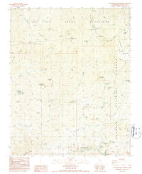
1986 Map of California Hot Springs
USGS Topo · Published 1987About this map
California Hot Springs serves as the focal point of this mid-1980s survey, situated along Deer Creek in the southern Sierra Nevada. The map documents a landscape defined by seasonal camps and early foothill commerce, featuring the Eagle Hotel and the Hot Springs Ranger Station near the community of Pine Flat. To the north, the Tule River Indian Reservation encompasses high-elevation terrain including the Parker Peak Grove and North Cold Spring Grove, which protect stands of giant sequoias. Evidence of historical land use is visible through several former locations like McDermott Camp and Millard Corral, while the Bull Pony Mine Prospects suggest earlier mineral exploration in the canyons of Rube Creek. Extensive four-wheel-drive routes such as Bond 4WD and Rattlesnake 4WD underscore the area's transition toward recreational and forest management use.
Find a feature on this map
69 named features on this map. Tap any name to fly to it.
Don’t see what you’re looking for? This feature index may not catch every label — zoom into the map to look around manually.
Map Details
Editions of this 1986 California Hot Springs Map
2 editions found
Other maps of this area

1904 · Kaweah
USGS Topo · 1:125,000

1909 · Kaweah
USGS Topo · 1:125,000

1936 · White River
USGS Topo · 1:62,500

1936 · Tobias Peak
USGS Topo · 1:125,000

1937 · Kaweah
USGS Topo · 1:125,000

1943 · Tobias Peak
USGS Topo · 1:125,000

1945 · Tobias Peak
USGS Topo · 1:62,500

1948 · Bakersfield
USGS Topo · 1:250,000

1948 · Fresno
USGS Topo · 1:250,000
1952 · White River
USGS Topo · 1:62,500