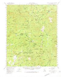
1958 Map of California Hot Springs
USGS Topo · Published 1974About this map
California Hot Springs serves as a central hub in this high-elevation landscape within the Sequoia National Forest, surveyed in the late 1950s. The region is defined by its deep groves of Sierra Redwoods, including the Starvation Creek Grove and Parker Peak Grove, which dominate the upper elevations of the Sierra Nevada. The map reveals a mountain economy transitioning between natural resource extraction and early alpine recreation, evidenced by the presence of the Tungstore Mine and Bull Point Mine alongside vacation spots like the White River Summer Home Tract and Leavis Flat Campground.
Find a feature on this map
206 named features on this map. Tap any name to fly to it.
Don’t see what you’re looking for? This feature index may not catch every label — zoom into the map to look around manually.
Map Details
Editions of this 1958 California Hot Springs Map
3 editions found
Other maps of this area

1904 · Kaweah
USGS Topo · 1:125,000

1905 · Olancha
USGS Topo · 1:125,000

1905 · Fairview
USGS Topo · 1:24,000

1906 · Kernville
USGS Topo · 1:125,000

1907 · Olancha
USGS Topo · 1:125,000

1908 · Kernville
USGS Topo · 1:125,000

1909 · Kaweah
USGS Topo · 1:125,000

1918 · Fairview
USGS Topo · 1:31,680

1920 · Delonagha
USGS Topo · 1:62,500

1926 · Glennville
USGS Topo · 1:62,500