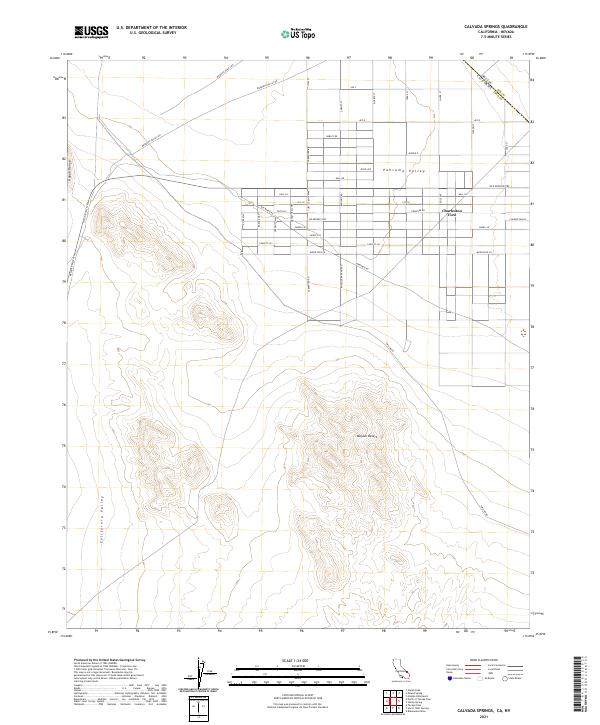
2021 Map of Calvada Springs
USGS Topo · Published 2021About this map
Charleston View serves as the primary point of settlement in this arid landscape where the eastern edge of Inyo County meets the Nevada state line. The community is defined by a rigid grid of residential streets with evocative names such as Sun Baked Rd, Frontier Rd, and Turtle Rock Way. This 2021 survey illustrates how modern desert living occupies the northern reaches of the Mojave Desert, positioned between the topographical rises of the Nopah Range and the expanse of the Pahrump Valley. The historic corridor of the Old Spanish Trl cuts across the northern section of the map, providing a tangible link to early western migration routes that once traversed the California Valley. The map’s detailed road network, including mineral-themed names like Zircon St and Gold St, highlights the planned nature of this remote borderland community.
Find a feature on this map
42 named features on this map. Tap any name to fly to it.
Don’t see what you’re looking for? This feature index may not catch every label — zoom into the map to look around manually.
Map Details
Editions of this 2021 Calvada Springs Map
This is the sole edition of this map. No revisions or reprints were ever made.
Other maps of this area

1907 · Las Vegas
USGS Topo · 1:250,000

1908 · Furnace Creek
USGS Topo · 1:250,000

1908 · Las Vegas
USGS Topo · 1:250,000

1910 · Furnace Creek
USGS Topo · 1:250,000

1910 · Ivanpah
USGS Topo · 1:250,000

1912 · Ivanpah
USGS Topo · 1:250,000

1933 · Avawatz Mountains
USGS Topo · 1:250,000

1942 · Ivanpah
USGS Topo · 1:250,000

1947 · Trona
USGS Topo · 1:250,000

1947 · Kingman
USGS Topo · 1:250,000