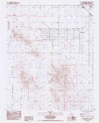
1984 Map of Calvada Springs
USGS Topo · Published 1985About this map
Pahrump Valley straddles the high-desert border between California and Nevada in this mid-1980s provisional study. The settlement of Calvada Springs serves as a primary reference point, situated near the intersection of the modern Old Spanish Trail Highway and the historic Von Schmidt Boundary (1873). This boundary line represents the 19th-century effort to define the state line, which remains a critical marker for local land records and historical surveys.
Find a feature on this map
10 named features on this map. Tap any name to fly to it.
Don’t see what you’re looking for? This feature index may not catch every label — zoom into the map to look around manually.
Map Details
Editions of this 1984 Calvada Springs Map
This is the sole edition of this map. No revisions or reprints were ever made.
Other maps of this area

1907 · Las Vegas
USGS Topo · 1:250,000

1908 · Furnace Creek
USGS Topo · 1:250,000

1908 · Las Vegas
USGS Topo · 1:250,000

1910 · Furnace Creek
USGS Topo · 1:250,000

1910 · Ivanpah
USGS Topo · 1:250,000

1912 · Ivanpah
USGS Topo · 1:250,000

1933 · Avawatz Mountains
USGS Topo · 1:250,000

1942 · Ivanpah
USGS Topo · 1:250,000

1947 · Trona
USGS Topo · 1:250,000

1947 · Kingman
USGS Topo · 1:250,000