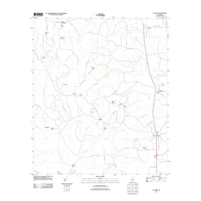
2011 Map of Calvert
USGS Topo · Published 2011About this map
Fairford and Malcolm anchor this area of southwestern Alabama, where small communities are defined by the winding drainages of Poll Bayou and Bates Creek. The landscape transition from the higher ground of Coon Hill Ridge and Hurricane Ridge down toward the river bottoms is marked by a network of rural roads such as Sank Town Rd and Sullivan Hollow Rd. Genealogists will find a high density of burial grounds including Liberty Cemetery, Union Cemetery, and Vaughn Cemetery, many associated with longstanding family settlements. The eastern edge of the quadrangle shows the established corridor of the Malcolm Post Office and Calvert Post Office, while the interior remains more dispersed, punctuated by landmarks like the Fairford Fire Tower and the Bowing Bridge crossing.
Find a feature on this map
74 named features on this map. Tap any name to fly to it.
Don’t see what you’re looking for? This feature index may not catch every label — zoom into the map to look around manually.
Map Details
Editions of this 2011 Calvert Map
This is the sole edition of this map. No revisions or reprints were ever made.
Other maps of this area

1943 · Choctaw Bluff
USGS Topo · 1:62,500

1943 · Tensaw
USGS Topo · 1:62,500

1943 · Citronelle
USGS Topo · 1:62,500

1943 · McIntosh
USGS Topo · 1:62,500

1944 · McIntosh
USGS Topo · 1:62,500

1944 · Tensaw
USGS Topo · 1:62,500

1946 · Citronelle
USGS Topo · 1:62,500

1946 · Choctaw Bluff
USGS Topo · 1:62,500

1953 · Andalusia
USGS Topo · 1:250,000

1953 · Hattiesburg
USGS Topo · 1:250,000