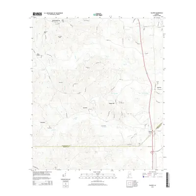
2014 Map of Calvert
USGS Topo · Published 2014About this map
Calvert and the border of Washington and Mobile Counties define this rural landscape as it appeared in the early 21st century. The map reveals a distribution of longstanding rural communities such as Sims Chapel, Fairford, and Malcolm, often anchored by family-named landmarks and cemeteries. Notable genealogy points include the John Johnston Hill Springs Cemetery and Rivers Cemetery, reflecting the deep familial roots in the Piney Woods region. The drainage patterns of Poll Bayou and Bates Creek cross the terrain, influenced by topographic features like Coon Hill Ridge and Hurricane Ridge. Modern infrastructure is represented by ThyssenKrupp Drive, while older connections like the Bowing Bridge across Poll Bayou maintain the area's historical continuity.
Find a feature on this map
69 named features on this map. Tap any name to fly to it.
Don’t see what you’re looking for? This feature index may not catch every label — zoom into the map to look around manually.
Map Details
Editions of this 2014 Calvert Map
This is the sole edition of this map. No revisions or reprints were ever made.
Other maps of this area

1943 · Choctaw Bluff
USGS Topo · 1:62,500

1943 · Tensaw
USGS Topo · 1:62,500

1943 · Citronelle
USGS Topo · 1:62,500

1943 · McIntosh
USGS Topo · 1:62,500

1944 · McIntosh
USGS Topo · 1:62,500

1944 · Tensaw
USGS Topo · 1:62,500

1946 · Citronelle
USGS Topo · 1:62,500

1946 · Choctaw Bluff
USGS Topo · 1:62,500

1953 · Andalusia
USGS Topo · 1:250,000

1953 · Hattiesburg
USGS Topo · 1:250,000