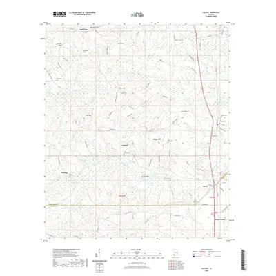
2020 Map of Calvert
USGS Topo · Published 2020About this map
The Washington and Mobile County line bisects this region, where the low-lying wetlands of Poll Bayou and Little Poll Bayou meet the higher ground of Hurricane Ridge and Coon Hill Ridge. The settlement pattern is defined by several small communities and historic burial sites, including the Union Baptist Cemetery near Fairford and the Saint Thomas Cemetery in Happy Hill. The landscape transitions from the wooded bottomlands around Bowing Bridge to the uplands of Hub Neck, revealing a patchwork of local roads like Roberts Road and Sandy Ridge Road that connect these rural outposts. Genealogists will find a high concentration of family-named landmarks and cemeteries, such as the Rivers, Vaughn, and Byrd cemeteries, which trace the deep roots of the Reid Settlement and the town of Calvert near the southeastern corner.
Find a feature on this map
84 named features on this map. Tap any name to fly to it.
Don’t see what you’re looking for? This feature index may not catch every label — zoom into the map to look around manually.
Map Details
Editions of this 2020 Calvert Map
This is the sole edition of this map. No revisions or reprints were ever made.
Other maps of this area

1943 · Choctaw Bluff
USGS Topo · 1:62,500

1943 · Tensaw
USGS Topo · 1:62,500

1943 · Citronelle
USGS Topo · 1:62,500

1943 · McIntosh
USGS Topo · 1:62,500

1944 · McIntosh
USGS Topo · 1:62,500

1944 · Tensaw
USGS Topo · 1:62,500

1946 · Citronelle
USGS Topo · 1:62,500

1946 · Choctaw Bluff
USGS Topo · 1:62,500

1953 · Andalusia
USGS Topo · 1:250,000

1953 · Hattiesburg
USGS Topo · 1:250,000