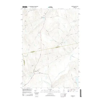
2014 Map of Cambridge
USGS Topo · Published 2014About this map
Cambridge serves as the primary hub in this region of central Maine, situated along the Main Stream Sebasticook River and the shores of Cambridge Pond. The landscape is defined by its small settlements and the dense network of family-named cemeteries that speak to the long-standing genealogical history of the area. Notable sites include the Greenfield Hill Airport and the smaller enclave at Pingree Center, where Pingree Pond and Pingree Cem mark the local landscape. The terrain rises to distinct peaks such as Crow Hill and Dorr Hill to the northwest, while numerous waterways including Packard Brook, Jimmy Brook, and Snow Brook drain the wooded countryside. This survey captures a moment of modern continuity in a rural area where the legacy of early families is preserved through landmarks like Tyler Cem, Gilbert Cem, and Mt Pleasant Cem.
Find a feature on this map
75 named features on this map. Tap any name to fly to it.
Don’t see what you’re looking for? This feature index may not catch every label — zoom into the map to look around manually.
Map Details
Editions of this 2014 Cambridge Map
This is the sole edition of this map. No revisions or reprints were ever made.
Other maps of this area

1913 · Skowhegan
USGS Topo · 1:62,500

1930 · Pittsfield
USGS Topo · 1:48,000

1932 · Pittsfield
USGS Topo · 1:62,500

1933 · Pittsfield
USGS Topo · 1:62,500

1933 · Guilford
USGS Topo · 1:62,500

1937 · Guilford
USGS Topo · 1:62,500

1948 · Bangor
USGS Topo · 1:250,000

1948 · Kingsbury
USGS Topo · 1:62,500

1950 · Kingsbury
USGS Topo · 1:62,500

1954 · Millinocket
USGS Topo · 1:250,000