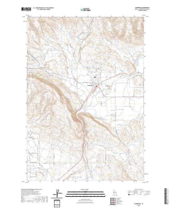
2024 Map of Cambridge
USGS Topo · Published 2024About this map
Cambridge serves as the focal point of this Washington County landscape, situated where Pine Creek and Rush Creek meet the Weiser River. This modern survey illustrates a valley defined by its agricultural and transit corridors, including the Middle-Valley-Ditch and the Weiser River National Recreation Trl, which follows the historic path of the railroad through the Salubria Valley. To the south, the terrain opens into the Middle Valley, while the western edges rise toward Fairchild Gulch and Shoe Peg Valley. Local heritage is anchored by sites like the Cambridge Cem and Salubria Cem, reflecting the deep roots of these ranching and farming communities. The road network, including Stage Coach RD and Old HWY, traces the early movement patterns through this Idaho interior, connecting disparate ranchlands along Keithly Creek and Dixie Creek to the central settlement.
Find a feature on this map
53 named features on this map. Tap any name to fly to it.
Don’t see what you’re looking for? This feature index may not catch every label — zoom into the map to look around manually.
Map Details
Editions of this 2024 Cambridge Map
This is the sole edition of this map. No revisions or reprints were ever made.
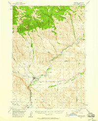
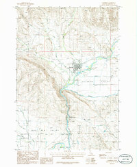
Historical Maps of Cambridge Through Time
3 maps found