1986 Map of Cambridge
USGS Topo · Published 1986About this map
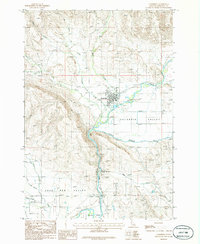
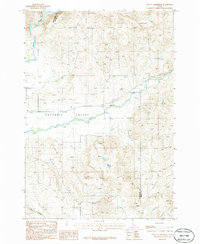
Cambridge serves as the focal point of this mid-1980s topographic record, situated where several drainages converge in the Salubria Valley. The town's layout is clearly visible, including the local Fairground and a nearby Cem northwest of the main settlement. The agricultural character of the region is defined by the management of the Little Weiser River, which is diverted through the Middle Valley Canal and the Middle Valley Ditch to sustain the surrounding valley floors.
Find a feature on this map
19 named features on this map. Tap any name to fly to it.
Don’t see what you’re looking for? This feature index may not catch every label — zoom into the map to look around manually.
Map Details
Editions of this 1986 Cambridge Map
This is the sole edition of this map. No revisions or reprints were ever made.
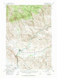
Other maps of this area

1897 · Weiser
USGS Topo · 1:125,000

1953 · Mann Creek
USGS Topo · 1:62,500

1955 · Baker
USGS Topo · 1:250,000
1957 · Cambridge
USGS Topo · 1:62,500
1957 · Crane Creek Reservoir
USGS Topo · 1:62,500
1957 · Sturgill Peak
USGS Topo · 1:62,500

1959 · Baker
USGS Topo · 1:250,000

1980 · McCall
USGS Topo · 1:100,000

1980 · Weiser
USGS Topo · 1:100,000
1986 · East of Cambridge
USGS Topo · 1:24,000