
1897 Map of Weiser
USGS Topo · Published 1897About this map
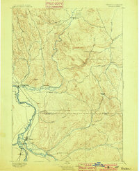
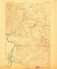
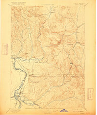
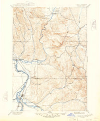
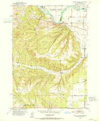
The Snake River carves a deep boundary between Idaho and Oregon in this late nineteenth-century survey, defining the industrial and agricultural potential of the region. Significant settlement clusters are established at Weiser and Payette, where the Oregon Short Line railroad follows the riverbank to facilitate trade and transport. The map details a complex network of waterways, including the Weiser River, Malheur River, and Payette River, which converge in this arid basin.
Find a feature on this map
34 named features on this map. Tap any name to fly to it.
Don’t see what you’re looking for? This feature index may not catch every label — zoom into the map to look around manually.
Map Details
Editions of this 1897 Weiser Map
5 editions found
Other maps of this area

1892 · Boise
USGS Topo · 1:125,000

1894 · Squaw Creek
USGS Topo · 1:125,000

1897 · Boise
USGS Topo · 1:125,000

1898 · Nampa
USGS Topo · 1:125,000

1906 · Mitchell Butte
USGS Topo · 1:125,000

1911 · Meadows
USGS Topo · 1:125,000

1915 · Pine
USGS Topo · 1:125,000
1951 · Moores Hollow
USGS Topo · 1:24,000

1951 · Malheur Butte
USGS Topo · 1:24,000

1951 · Moores Hollow
USGS Topo · 1:62,500