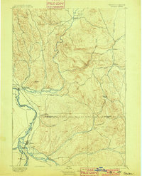
1897 Map of Weiser
USGS Topo · Published 1901About this map
Weiser serves as the focal point of this late 19th-century survey, situated at the confluence of the Weiser River and the Snake River. The map captures the borderlands of Idaho and Oregon during a period of significant regional organization, showing the boundary between Washington Co. and Canyon Co. and the path of the Short Line railroad. The layout of the land reveals a series of critical water sources for early settlers, from the wide Payette River in the south to the intricate drainage system of Crane Creek and Little Willow Creek.
Find a feature on this map
38 named features on this map. Tap any name to fly to it.
Don’t see what you’re looking for? This feature index may not catch every label — zoom into the map to look around manually.
Map Details
Editions of this 1897 Weiser Map
5 editions found
Other maps of this area

1892 · Boise
USGS Topo · 1:125,000

1894 · Squaw Creek
USGS Topo · 1:125,000

1897 · Boise
USGS Topo · 1:125,000

1897 · Weiser
USGS Topo · 1:125,000

1898 · Nampa
USGS Topo · 1:125,000

1906 · Mitchell Butte
USGS Topo · 1:125,000

1911 · Meadows
USGS Topo · 1:125,000

1915 · Pine
USGS Topo · 1:125,000

1951 · Moores Hollow
USGS Topo · 1:24,000

1951 · Malheur Butte
USGS Topo · 1:24,000