1897 Map of Weiser
USGS Topo · Published 1948About this map
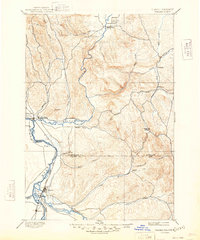
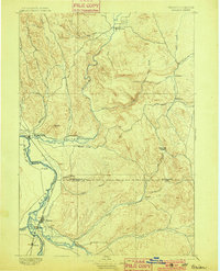
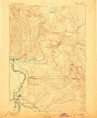
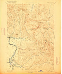
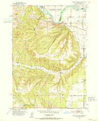
The Snake River corridor defines the western edge of this landscape, marking the vital border between Idaho and Oregon in the late nineteenth century. Established at the confluence of the Weiser River, the town of Weiser serves as a central hub for the surrounding ranching and agricultural valleys. This 1894 reconnaissance survey illustrates the early settlement patterns of Washington and Canyon counties, revealing how community development followed the water sources of Crane Creek, Little Willow Creek, and the Payette River. To the south, the neighboring towns of Payette, Washoe, and Ontario appear at a formative stage of their growth. The interior terrain is a complex network of drainages and landmarks such as Paddock Valley, Cherry Gulch, and Sand Hollow, providing a detailed look at the rural landscape before modern infrastructure transformed the high desert and river bottoms.
Find a feature on this map
37 named features on this map. Tap any name to fly to it.
Don’t see what you’re looking for? This feature index may not catch every label — zoom into the map to look around manually.
Map Details
Editions of this 1897 Weiser Map
5 editions found
Other maps of this area

1892 · Boise
USGS Topo · 1:125,000

1894 · Squaw Creek
USGS Topo · 1:125,000

1897 · Boise
USGS Topo · 1:125,000

1897 · Weiser
USGS Topo · 1:125,000

1898 · Nampa
USGS Topo · 1:125,000

1906 · Mitchell Butte
USGS Topo · 1:125,000

1911 · Meadows
USGS Topo · 1:125,000

1915 · Pine
USGS Topo · 1:125,000
1951 · Moores Hollow
USGS Topo · 1:24,000

1951 · Malheur Butte
USGS Topo · 1:24,000