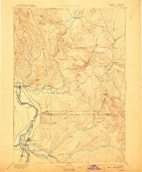
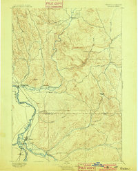
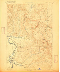
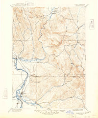
1897 Map of Weiser
USGS Topo · Published 1908About this map
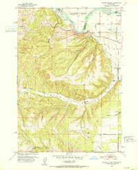
Weiser serves as the focal point of this reconnaissance survey, situated at the confluence where the Weiser River meets the Snake River. The landscape reflects a transitional era in the late nineteenth century, dominated by the Oregon Short Line railroad which parallels the Snake River through Payette and Ontario. To the north, the terrain becomes more complex as the river systems of Crane Creek and Mann Creek carve through the uplands. Small early settlements like Middle Valley and Wilburns are established along these watercourses, while the lower valleys show the early development of agricultural and transportation corridors. The survey captures the intricate drainage patterns of Little Willow Creek and Sage Creek, illustrating how the hydrology dictated the placement of pioneer-era routes and the Washington Co. Canyon Co. boundary line.
Find a feature on this map
38 named features on this map. Tap any name to fly to it.
Don’t see what you’re looking for? This feature index may not catch every label — zoom into the map to look around manually.
Map Details
Editions of this 1897 Weiser Map
5 editions found
Other maps of this area

1892 · Boise
USGS Topo · 1:125,000

1894 · Squaw Creek
USGS Topo · 1:125,000

1897 · Boise
USGS Topo · 1:125,000

1897 · Weiser
USGS Topo · 1:125,000

1898 · Nampa
USGS Topo · 1:125,000

1906 · Mitchell Butte
USGS Topo · 1:125,000

1911 · Meadows
USGS Topo · 1:125,000

1915 · Pine
USGS Topo · 1:125,000
1951 · Moores Hollow
USGS Topo · 1:24,000

1951 · Malheur Butte
USGS Topo · 1:24,000