
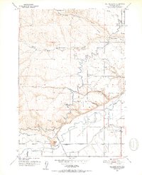
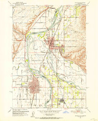
1951 Map of Malheur Butte
USGS Topo · Published 1952About this map
Malheur Butte dominates the southern landscape of this 1951 survey, standing as a prominent landmark above the winding Malheur River. The area showcases a sophisticated irrigation network essential for high-desert agriculture, featuring the Owyhee Canal, the Bros Man Ditch, and a series of numbered canyons including Ontario Canyon No 1. These water systems supported rural life at Beacon and the community hubs at Ontario Heights Church and the Ontario Heights Grange. The presence of Ontario Airport and a high-pressure Pipe Line running through Jacobsen Gulch illustrates the mid-century infrastructure developing alongside traditional ranching. Local genealogists may find interest in the scattered residential footprints along Butler Blvd and the northern reaches of Butterfield Springs, mapping the proximity of family homes to the vital levee systems guarding the river plain.
Find a feature on this map
22 named features on this map. Tap any name to fly to it.
Don’t see what you’re looking for? This feature index may not catch every label — zoom into the map to look around manually.
Map Details
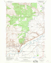
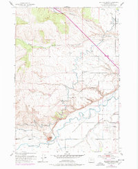
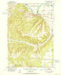
Editions of this 1951 Malheur Butte Map
4 editions found
Other maps of this area

1897 · Weiser
USGS Topo · 1:125,000

1898 · Nampa
USGS Topo · 1:125,000

1906 · Mitchell Butte
USGS Topo · 1:125,000
1951 · Moores Hollow
USGS Topo · 1:24,000

1951 · Moores Hollow
USGS Topo · 1:62,500
1951 · Payette
USGS Topo · 1:24,000
1951 · Weiser South
USGS Topo · 1:24,000

1955 · Baker
USGS Topo · 1:250,000

1955 · Boise
USGS Topo · 1:250,000

1958 · Boise
USGS Topo · 1:250,000