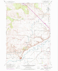
1951 Map of Malheur Butte
USGS Topo · Published 1977About this map
Malheur Butte dominates the southern landscape of this Malheur County region, rising above the convergence of the Malheur River and an extensive irrigation network. The agricultural development of the mid-20th century is clearly etched into the terrain through the paths of the Owyhee Canal, Ontario Canal No 1, and Ontario Canal No 3, which redirect water from the river to the surrounding heights.
Find a feature on this map
24 named features on this map. Tap any name to fly to it.
Don’t see what you’re looking for? This feature index may not catch every label — zoom into the map to look around manually.
Map Details
Editions of this 1951 Malheur Butte Map
4 editions found
Other maps of this area

1897 · Weiser
USGS Topo · 1:125,000

1898 · Nampa
USGS Topo · 1:125,000

1906 · Mitchell Butte
USGS Topo · 1:125,000

1951 · Moores Hollow
USGS Topo · 1:24,000

1951 · Malheur Butte
USGS Topo · 1:24,000

1951 · Moores Hollow
USGS Topo · 1:62,500

1951 · Payette
USGS Topo · 1:24,000

1951 · Weiser South
USGS Topo · 1:24,000

1955 · Baker
USGS Topo · 1:250,000

1955 · Boise
USGS Topo · 1:250,000