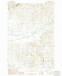
1986 Map of East of Cambridge
USGS Topo · Published 1986About this map
Salubria Valley provides the topographic focus for this mid-1980s survey, where the confluence of the Weiser River and Little Weiser River defines the local drainage and agricultural potential. This provisional study captures a landscape of transition, where the level valley floor gives way to the sharp relief of the surrounding uplands. Local landmarks such as Monday 3542 and Robbin 3463 stand as prominent survey points in the high country, marking the rugged terrain that borders the farmed lowlands. The presence of a local Cem near the riverbanks indicates the enduring settlement patterns in this part of Washington County, while the seasonal flow of Dixie Creek contributes to the complex network of irrigation and natural watercourses essential to the region's ranching history.
Find a feature on this map
8 named features on this map. Tap any name to fly to it.
Don’t see what you’re looking for? This feature index may not catch every label — zoom into the map to look around manually.
Map Details
Editions of this 1986 East of Cambridge Map
This is the sole edition of this map. No revisions or reprints were ever made.
Other maps of this area

1894 · Squaw Creek
USGS Topo · 1:125,000

1897 · Weiser
USGS Topo · 1:125,000

1911 · Meadows
USGS Topo · 1:125,000

1954 · Council
USGS Topo · 1:62,500

1955 · Baker
USGS Topo · 1:250,000

1957 · Cambridge
USGS Topo · 1:62,500

1957 · Crane Creek Reservoir
USGS Topo · 1:62,500

1959 · Baker
USGS Topo · 1:250,000

1970 · Granger Butte
USGS Topo · 1:24,000

1980 · McCall
USGS Topo · 1:100,000