
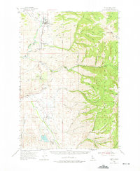
1954 Map of Council
USGS Topo · Published 1956About this map
Council serves as the focal point of this mid-1950s survey, situated along the Weiser River and served by the Union Pacific railroad. The map documents a landscape in transition, where educational and agricultural hubs like the Cottonwood Sch (Aban'd) and Hillsdale School (Aban'd) are already noted as abandoned. The settlement of Mesa and its accompanying Mesa Siding underscore the importance of the rail line to the local economy, while the Landing Field near the town center indicates modern infrastructure reaching the valley.
Find a feature on this map
57 named features on this map. Tap any name to fly to it.
Don’t see what you’re looking for? This feature index may not catch every label — zoom into the map to look around manually.
Map Details
Editions of this 1954 Council Map
2 editions found
Other maps of this area

1894 · Squaw Creek
USGS Topo · 1:125,000

1897 · Weiser
USGS Topo · 1:125,000

1911 · Meadows
USGS Topo · 1:125,000

1953 · Smiths Ferry
USGS Topo · 1:62,500

1954 · New Meadows
USGS Topo · 1:62,500

1954 · Cascade
USGS Topo · 1:62,500

1955 · Baker
USGS Topo · 1:250,000

1957 · Cambridge
USGS Topo · 1:62,500

1957 · Crane Creek Reservoir
USGS Topo · 1:62,500

1957 · Hornet
USGS Topo · 1:62,500