
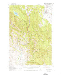
1954 Map of New Meadows
USGS Topo · Published 1956About this map
New Meadows serves as the hub of this mid-century Idaho landscape, where the Pacific and Idaho Northern Railroad traces the path of the Little Salmon River and Mud Creek. The map documents a period of transition in the timber and ranching country of the Payette National Forest, illustrated by the presence of small, dispersed settlements like Rubicon, Tamarack, and Evergreen. Local history is preserved in the location of the Glendale School and the formerly active White School, alongside family landmarks such as the Winkler Cem. The terrain is dominated by the Blue Bunch Ridge and the Weiser River drainage, where the Weiser Canal and various gulches—First Gulch, Second Gulch, and Third Gulch—reflect the irrigation and mining efforts that shaped the local economy. From the waters of Lost Valley Reservoir to the Landing Strip at the valley floor, this survey captures the infrastructure of the 1950s high country.
Find a feature on this map
63 named features on this map. Tap any name to fly to it.
Don’t see what you’re looking for? This feature index may not catch every label — zoom into the map to look around manually.
Map Details
Editions of this 1954 New Meadows Map
2 editions found
Other maps of this area

1911 · Meadows
USGS Topo · 1:125,000

1920 · Seven Devils Mining District
USGS Topo · 1:48,000

1938 · Riggins
USGS Topo · 1:96,000

1945 · Riggins
USGS Topo · 1:125,000

1954 · Council
USGS Topo · 1:62,500

1954 · Cascade
USGS Topo · 1:62,500

1955 · Baker
USGS Topo · 1:250,000

1955 · Grangeville
USGS Topo · 1:250,000

1957 · Cambridge
USGS Topo · 1:62,500

1957 · Cuprum
USGS Topo · 1:62,500