
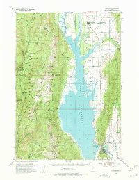
1954 Map of Cascade
USGS Topo · Published 1956About this map
Cascade Reservoir dominates this mid-1950s survey, illustrating the controlled inundation areas along the North Fork Payette River. The landscape is a study in transitional infrastructure, showing the Union Pacific railroad corridor and local settlements like Donnelly and Arling positioned along the eastern shore. To the east, the agricultural valley floor near Roseberry is contrasted by the high, wooded peaks of the Boise National Forest and Payette National Forest to the west. Local history is anchored by the Roseberry Cem and Hopps Cemetery, while the western mountains reveal early natural resource extraction at the Mica Mine and administrative sites like the Corral Creek Guard Station. A unique detail includes the spillway elevation recorded in late 1954, capturing the reservoir's status shortly after its creation.
Find a feature on this map
73 named features on this map. Tap any name to fly to it.
Don’t see what you’re looking for? This feature index may not catch every label — zoom into the map to look around manually.
Map Details
Editions of this 1954 Cascade Map
2 editions found
Other maps of this area

1894 · Squaw Creek
USGS Topo · 1:125,000

1909 · Garden Valley
USGS Topo · 1:125,000

1911 · Meadows
USGS Topo · 1:125,000

1953 · Smiths Ferry
USGS Topo · 1:62,500

1953 · Boiling Springs
USGS Topo · 1:62,500

1954 · Gold Fork
USGS Topo · 1:62,500

1954 · Council
USGS Topo · 1:62,500

1954 · New Meadows
USGS Topo · 1:62,500

1955 · Baker
USGS Topo · 1:250,000

1957 · Challis
USGS Topo · 1:250,000