Old Maps of Cascade, Idaho
Explore 20 old maps of Cascade, spanning from 1894 to today. These high-resolution historic maps reveal how streets, neighborhoods, landmarks, and natural features evolved over time — perfect for genealogy, metal detecting, research, and local history exploration.
What you can do with these maps:
- See how Cascade changed over time: Compare historical maps to modern-day views to trace roads, homesites, rail lines & more.
- View detailed metadata: Each map includes creators, publishers, year, scale, and archive source.
- Overlay maps with satellite & LiDAR: Visualize the past alongside modern tools to explore terrain & human change.
- Trusted historical sources: Maps sourced from the USGS, Library of Congress, and other archives.
- Access maps your way: View online, download high-res files, or order prints for personal or research use.
Start exploring old maps of Cascade to uncover forgotten places, hidden landmarks, and the deep history beneath your feet.
Cascade, ID maps
(20)- 1894 Map of Squaw Creek
 1894 Squaw Creek1894 Print · USGSCentral Idaho in the 1890s was a landscape of mountain valleys and river crossings where early pioneers established remote outposts. Trace the locations of historic river access at Smith Ferry and early industry at Walker Mill or the settlement of Ola.5 unique versions available
 - 1911 Map of Meadows
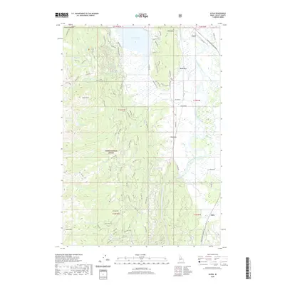
 1911 Meadows1911 Print · USGSThe high meadows and river valleys of central Idaho are seen here during the early years of the national forest system. Genealogists and historians can locate remote settlements like Lardo and Crawford, or trace rural schoolhouses including Hayes School and Rutledge School.2 unique versions available
 - 1953 Map of Smiths Ferry, 1955 Print
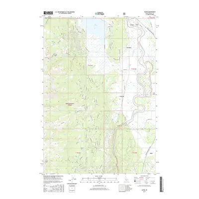
 1953 Smiths Ferry1955 Print · USGSThe Payette River valley in the early fifties was a landscape of remote rail stops and mountain lookouts. Genealogists can trace rural school locations like Lower Alpha School (Aban'd) or follow the UNION PACIFIC line through Smiths Ferry.3 unique versions available
 - 1954 Map of Cascade, 1956 Print
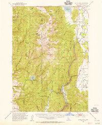
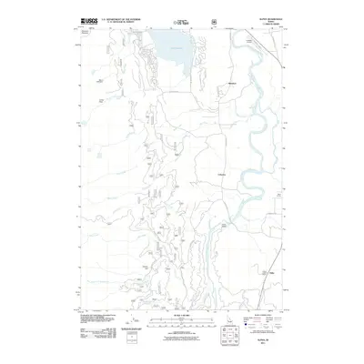
 1954 Cascade1956 Print · USGSThe High Valley of the Payette River is captured here in the mid-fifties as the new reservoir redefines the landscape. Genealogists and historians can locate early settlements like Roseberry and Donnelly, the Hopps Cemetery, and high-country landmarks like Mica Mine.2 unique versions available
 - 1955 Map of Baker, 1964 Print
 1955 Baker1964 Print · USGSThe Oregon-Idaho borderlands are captured here in the mid-fifties as the Snake River underwent massive changes from dam construction. Trace the Oregon Trail Memorial Monument near Baker, find early mines like Virtue Mine, and follow the Union Pacific Railroad through Huntington.4 unique versions available
 - 1959 Map of Baker
 1959 Baker1959 Print · USGSThe Oregon and Idaho borderlands come alive in the late fifties, showing the rugged corridor along the Snake River and the high peaks of the Wallowa Mountains. Researchers can trace the legacy of the Union Pacific railroad or locate historic mining sites like the Flagstaff Mine and Virtue Mine.2 unique versions available
 - 1980 Map of McCall, 1993 Print
 1980 McCall1993 Print · USGSThe high timber country and glacial lakes of the West Mountains are documented here in the early eighties. Genealogists and local historians can trace the Union Pacific rail line and family-linked sites like Roseberry, Starkey, and the North Hornet Mine.2 unique versions available
 - 1980 Map of Weiser, 1993 Print
 1980 Weiser1993 Print · USGSThe Snake River valley and the foothills of the Boise Mountains are captured here in the 1980s, showing the vital rail and water infrastructure of the region. Researchers can trace the Union Pacific line through Payette or locate rural landmarks like Hog Cove Butte and Wilburn Butte.
 - 1985 Map of Alpha, 1986 Print
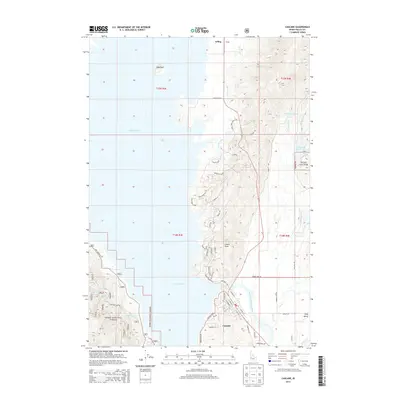
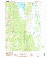 1985 Alpha1986 Print · USGSLong Valley and the high West Mountains are documented here during the mid-eighties, showing the interface of timberlands and river bottom. Researchers can trace the river-and-rail corridor through Alpha, Cabarton, and Belvidere or locate remote sites like Shirts Lake.2 unique versions available
 - 1985 Map of Cascade, 1986 Print
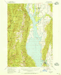
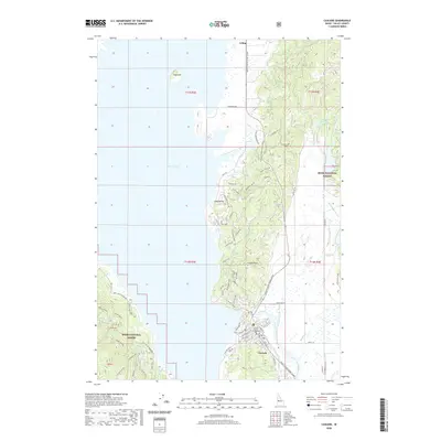
 1985 Cascade1986 Print · USGSValley County is shown in the mid-1980s as the town of Cascade sits along its namesake reservoir. Researchers can trace the Old R R Grade and locate features like the Landing Strip, Crown Point, and the Trailer Park.
 - 2011 Map of Cascade, 2011 Print
 2011 Cascade2011 Print · USGSCovers Cascade, including Valley County, United States, and other nearby areas
 - 2011 Map of Alpha, 2011 Print
 2011 Alpha2011 Print · USGSCovers Cascade, including Valley County, United States, and other nearby areas
 - 2013 Map of Cascade, 2013 Print
 2013 Cascade2013 Print · USGSCovers Cascade, including Valley County, United States, and other nearby areas
 - 2013 Map of Alpha, 2013 Print
 2013 Alpha2013 Print · USGSCovers Cascade, including Valley County, United States, and other nearby areas
 - 2017 Map of Cascade, 2017 Print
 2017 Cascade2017 Print · USGSCovers Cascade, including Valley County, United States, and other nearby areas
 - 2017 Map of Alpha, 2017 Print
 2017 Alpha2017 Print · USGSCovers Cascade, including Valley County, United States, and other nearby areas
 - 2020 Map of Alpha, 2020 Print
 2020 Alpha2020 Print · USGSCovers Cascade, including Valley County, United States, and other nearby areas
 - 2020 Map of Cascade, 2020 Print
 2020 Cascade2020 Print · USGSCovers Cascade, including Valley County, United States, and other nearby areas
 - 2024 Map of Alpha, 2024 Print
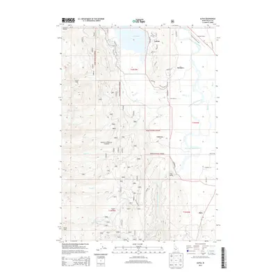
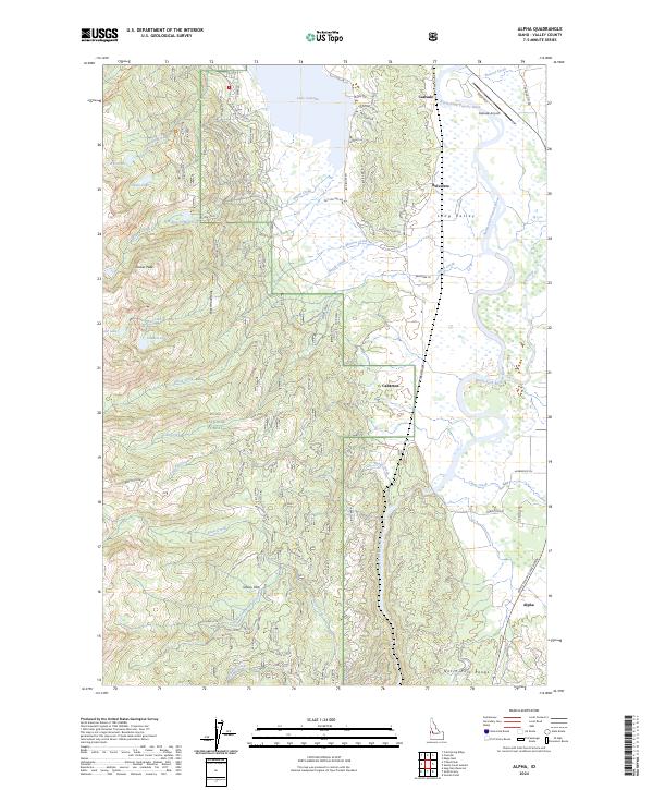 2024 Alpha2024 Print · USGSValley County, Idaho, is captured here in the contemporary era as a landscape of river valleys and high peaks. Genealogists and locals can trace the communities of Belvidere and Alpha or locate landmarks like Lake Cascade and Collier Peak.
 - 2024 Map of Cascade, 2024 Print
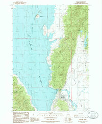
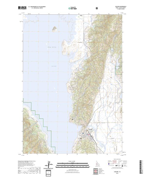 2024 Cascade2024 Print · USGSCentral Idaho's high valley landscape is captured here in the mid-2020s, showing the developed shoreline of Lake Cascade. Researchers can locate the Valley County Courthouse and trace local family history at Margaret Cem and Crown Point Cem.
End of results
Showing maps 1-20 of 20
Top cities near Cascade
Frequently asked questions
- What are the different types of historical maps available for Cascade?
- What is the oldest map of Cascade?
- Where can I purchase historical maps of Cascade for my home or office?
- Where can I download high-res historical maps of Cascade?
- Are there historical topographic maps available for Cascade?
- Is there historical aerial imagery available for Cascade?
- Where are historical maps of Cascade sourced from?