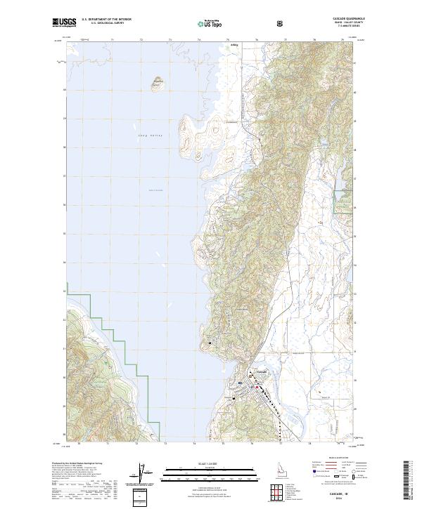
2024 Map of Cascade
USGS Topo · Published 2024About this map
Cascade serves as the regional hub and county seat on this modern survey of central Idaho, with the Valley County Courthouse anchoring the town center. The landscape is defined by the expansive Lake Cascade, which occupies much of Long Valley and transitions into the timbered slopes of the Boise National Forest to the east and west. This contemporary view captures a developed recreational and residential shoreline, where numerous small roads like Pine Lakes Ranch Dr and Crown Point Pkwy lace the western edge of the town near the water.
Find a feature on this map
77 named features on this map. Tap any name to fly to it.
Don’t see what you’re looking for? This feature index may not catch every label — zoom into the map to look around manually.
Map Details
Editions of this 2024 Cascade Map
This is the sole edition of this map. No revisions or reprints were ever made.
Other maps of this area

1894 · Squaw Creek
USGS Topo · 1:125,000

1909 · Garden Valley
USGS Topo · 1:125,000

1911 · Meadows
USGS Topo · 1:125,000

1953 · Smiths Ferry
USGS Topo · 1:62,500

1953 · Boiling Springs
USGS Topo · 1:62,500

1954 · Gold Fork
USGS Topo · 1:62,500

1954 · Cascade
USGS Topo · 1:62,500

1955 · Baker
USGS Topo · 1:250,000

1957 · Challis
USGS Topo · 1:250,000

1959 · Baker
USGS Topo · 1:250,000