
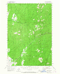
1954 Map of Gold Fork
USGS Topo · Published 1956About this map
Hot Spring and the small settlements of Crawford, Pearson, and Davis anchor the southern valleys of this mid-century survey. The landscape is defined by the complex drainage systems of the Gold Fork River and Little Gold Fork River, which flow through the heart of the Payette National Forest and Boise National Forest. A notable piece of local history is recorded along the valley floor, where an Old Railroad Grade and the Old Kennedy Valley Road trace former transportation corridors through Kennedy Valley. High-elevation observation points like Sloans Point Lookout and Gold Fork Lookout overlook the mountainous terrain, while the Historical Monument near Pearson marks a specific point of local heritage. The southern reaches are characterized by water management features such as Calendar Reservoir and Davis Reservoir, supporting the agricultural and ranching efforts in Horsethief Basin.
Find a feature on this map
56 named features on this map. Tap any name to fly to it.
Don’t see what you’re looking for? This feature index may not catch every label — zoom into the map to look around manually.
Map Details
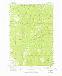
Editions of this 1954 Gold Fork Map
3 editions found
Other maps of this area

1894 · Squaw Creek
USGS Topo · 1:125,000

1909 · Garden Valley
USGS Topo · 1:125,000

1911 · Meadows
USGS Topo · 1:125,000

1953 · Smiths Ferry
USGS Topo · 1:62,500

1953 · Boiling Springs
USGS Topo · 1:62,500

1953 · Deadwood Reservoir
USGS Topo · 1:62,500

1954 · Warm Lake
USGS Topo · 1:62,500

1954 · Cascade
USGS Topo · 1:62,500

1955 · Baker
USGS Topo · 1:250,000

1957 · Challis
USGS Topo · 1:250,000