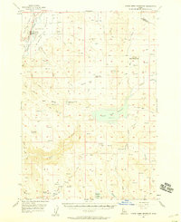
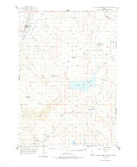
1957 Map of Crane Creek Reservoir
USGS Topo · Published 1958About this map
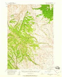
The Weiser River valley anchors this 1957 survey of Washington and Adams counties, showing a landscape defined by ranching, water management, and the Union Pacific railroad. The town of Midvale serves as the primary settlement, situated near the Midvale Cemetery and the junction of Keithly Creek and Beaver Creek. The map documents an extensive irrigation network, including the Crane Creek Reservoir with its Spillway and Gaging Station, as well as Paddock Valley Reservoir and Little Crane Creek Reservoir. Elevated landmarks like Star Butte and Hog Creek Butte rise above the drainage basins of the Middle Valley. Social history is preserved in the location of the South Crane School and the already noted Cozy Corners School (Aban'd), illustrating the shifting rural population during the mid-20th century.
Find a feature on this map
48 named features on this map. Tap any name to fly to it.
Don’t see what you’re looking for? This feature index may not catch every label — zoom into the map to look around manually.
Map Details
Editions of this 1957 Crane Creek Reservoir Map
2 editions found
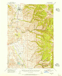
Other maps of this area

1894 · Squaw Creek
USGS Topo · 1:125,000

1897 · Weiser
USGS Topo · 1:125,000

1911 · Meadows
USGS Topo · 1:125,000

1952 · Weiser Cove
USGS Topo · 1:24,000

1953 · Mann Creek
USGS Topo · 1:62,500
1954 · Council
USGS Topo · 1:62,500

1955 · Baker
USGS Topo · 1:250,000
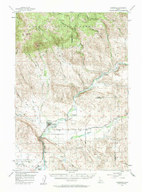
1957 · Cambridge
USGS Topo · 1:62,500
1957 · Sturgill Peak
USGS Topo · 1:62,500

1959 · Baker
USGS Topo · 1:250,000