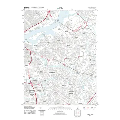
2011 Map of Camden
USGS Topo · Published 2011About this map
Petty Island sits at the heart of this riverine landscape, anchored by the infrastructure connecting Richmond, Pennsylvania, to the suburban expanses of New Jersey. This 2011 survey illustrates the dense urban and suburban development of Camden and its neighbors, characterized by an intricate network of residential neighborhoods like Wellwood, Jordantown, and Golden Triangle. The transition from industrial waterfronts near Port Richmond to the residential character of Merchantville and Haddonfield is clearly visible, with numerous parks and cemeteries serving as green lungs for the region.
Find a feature on this map
120 named features on this map. Tap any name to fly to it.
Don’t see what you’re looking for? This feature index may not catch every label — zoom into the map to look around manually.
Map Details
Editions of this 2011 Camden Map
This is the sole edition of this map. No revisions or reprints were ever made.
Other maps of this area

1888 · Mount Holly
USGS Topo · 1:62,500

1890 · Burlington
USGS Topo · 1:62,500

1891 · Philadelphia
USGS Topo · 1:62,500

1893 · Germantown
USGS Topo · 1:62,500

1893 · Burlington
USGS Topo · 1:62,500

1894 · Mount Holly
USGS Topo · 1:62,500

1894 · Philadelphia
USGS Topo · 1:62,500

1894 · Germantown
USGS Topo · 1:62,500

1896 · Germantown
USGS Topo · 1:62,500

1896 · Philadelphia
USGS Topo · 1:62,500