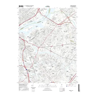
2016 Map of Camden
USGS Topo · Published 2016About this map
Petty Island and the industrial waterfronts of Philadelphia and Camden Counties define this 2016 landscape, where the Delaware River separates the dense urban grids of Port Richmond and Bridesburg from the New Jersey suburbs. The map captures a complex network of transportation and historical land use, featuring the prominent Betsy Ross Bridge and the Pennsylvania New Jersey railroad corridor. Significant acreage is dedicated to historic memorial sites including Harleigh Cem, Saint Peters Cem, and Crescent Burial Park, providing a vital record for genealogical research in these long-established communities. Inland, the map traces the winding course of the Cooper River as it passes through Cherry Hill and Erlton, where local landmarks like Iron Rock and Hopkins Pond punctuate the residential expansion of the mid-to-late twentieth century.
Find a feature on this map
106 named features on this map. Tap any name to fly to it.
Don’t see what you’re looking for? This feature index may not catch every label — zoom into the map to look around manually.
Map Details
Editions of this 2016 Camden Map
This is the sole edition of this map. No revisions or reprints were ever made.
Other maps of this area

1888 · Mount Holly
USGS Topo · 1:62,500

1890 · Burlington
USGS Topo · 1:62,500

1891 · Philadelphia
USGS Topo · 1:62,500

1893 · Germantown
USGS Topo · 1:62,500

1893 · Burlington
USGS Topo · 1:62,500

1894 · Mount Holly
USGS Topo · 1:62,500

1894 · Philadelphia
USGS Topo · 1:62,500

1894 · Germantown
USGS Topo · 1:62,500

1896 · Germantown
USGS Topo · 1:62,500

1896 · Philadelphia
USGS Topo · 1:62,500