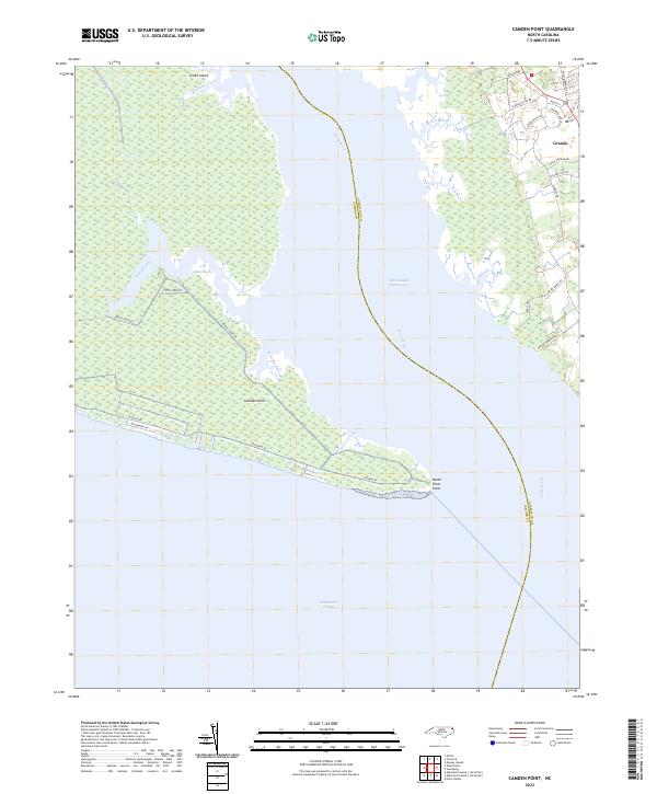
2022 Map of Camden Point
USGS Topo · Published 2022About this map
The North River divides this coastal landscape, separating the finger of land ending at Camden Point from the residential expansion around Grandy. This 2022 survey captures the modern development patterns of Currituck and Camden Counties, where suburban street networks like Carolina Club Dr and Charleston Dr contrast with the expansive wetlands of Black Swamp and Great Island. The map illustrates the vital role of the Intracoastal Waterway as it transitions from the river into the broad expanse of the Albemarle Sound. Land use is sharply defined between the protected marshy reaches of Broad Creek and the residential clusters near the shoreline. For those studying the geography of the Inner Banks, the sheet provides exact coordinates for local landmarks such as North River Point and the various creeks, including Hunting Creek and Duck Creek, that drain into the sound.
Find a feature on this map
31 named features on this map. Tap any name to fly to it.
Don’t see what you’re looking for? This feature index may not catch every label — zoom into the map to look around manually.
Map Details
Editions of this 2022 Camden Point Map
This is the sole edition of this map. No revisions or reprints were ever made.
Other maps of this area

1940 · Barco
USGS Topo · 1:62,500

1940 · Powells Point
USGS Topo · 1:62,500

1940 · Wade Point
USGS Topo · 1:62,500

1943 · Wade Point
USGS Topo · 1:62,500

1946 · Eastville
USGS Topo · 1:250,000

1946 · Currituck Sound
USGS Topo · 1:250,000

1948 · Wade Point
USGS Topo · 1:62,500

1948 · Elizabeth City
USGS Topo · 1:62,500

1953 · Norfolk
USGS Topo · 1:250,000

1961 · Eastville
USGS Topo · 1:250,000