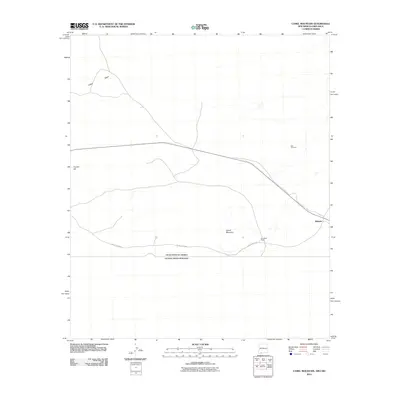
2010 Map of Camel Mountain
USGS Topo · Published 2010About this map
Birchfield Ranch and the small settlement of Malpais are established outposts in this arid landscape along the international boundary between the United States of America and Mexico. The terrain is defined by sparse but significant landmarks, such as the isolated Red Windmill and the topographic rise of Camel Mountain. Further west, Coyote Hill and the broad Indian Basin break the desert floor, providing essential points of reference for those navigating this borderland region. The road network is limited to rural routes like County Rd-B002 and A-001 County Rd, which cut across the high desert to connect remote ranching interests. This 2010 survey reflects a period of modern border management while maintaining the characteristic isolation of the southern New Mexico desert.
Find a feature on this map
9 named features on this map. Tap any name to fly to it.
Don’t see what you’re looking for? This feature index may not catch every label — zoom into the map to look around manually.
Map Details
Editions of this 2010 Camel Mountain Map
This is the sole edition of this map. No revisions or reprints were ever made.
Other maps of this area

1917 · Camel Mountain
USGS Topo · 1:62,500

1917 · Mt. Riley
USGS Topo · 1:62,500

1918 · Mt. Riley
USGS Topo · 1:62,500

1929 · Mt. Riley
USGS Topo · 1:62,500

1951 · Mt. Riley
USGS Topo · 1:62,500

1953 · El Paso
USGS Topo · 1:250,000

1959 · El Paso
USGS Topo · 1:250,000

1964 · El Paso
USGS Topo · 1:250,000

1965 · El Paso
USGS Topo · 1:250,000
1965 · Camel Mountain
USGS Topo · 1:24,000