
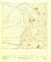
1917 Map of Camel Mountain
USGS Topo · Published 1917About this map
Isolated cattle ranches and high desert terrain define this arid landscape along the international border between New Mexico and Chihuahua. Surveyed in 1917, the map illustrates the sparse settlement patterns of the era, where survival depended on localized water sources and family operations like the Log Cabin Ranch, POL Ranch, and the Birchfield Ranch. The northern section is dominated by the volcanic forms of Eagle Nest and the depressions of Indian Basin, while the southern reaches track the El Paso and Southwestern railroad line. This rail corridor connects the small siding at Arena to the broader regional economy. The eastern edge captures the border between Luna and Dona Ana counties, marked by the prominent silhouette of Camel Mountain and the rough, lava-scarred terrain of Malpais.
Find a feature on this map
17 named features on this map. Tap any name to fly to it.
Don’t see what you’re looking for? This feature index may not catch every label — zoom into the map to look around manually.
Map Details
Editions of this 1917 Camel Mountain Map
2 editions found
Other maps of this area

1899 · Deming
USGS Topo · 1:125,000

1915 · Deming
USGS Topo · 1:125,000

1917 · Columbus
USGS Topo · 1:62,500

1917 · Mt. Riley
USGS Topo · 1:62,500

1918 · Mt. Riley
USGS Topo · 1:62,500

1918 · Columbus
USGS Topo · 1:62,500

1920 · Columbus
USGS Topo · 1:62,500

1929 · Mt. Riley
USGS Topo · 1:62,500

1941 · Aden
USGS Topo · 1:62,500

1943 · Aden
USGS Topo · 1:62,500