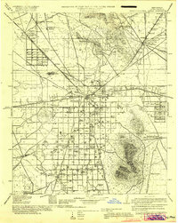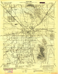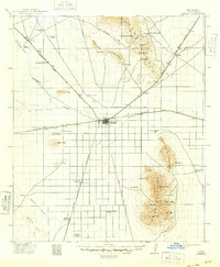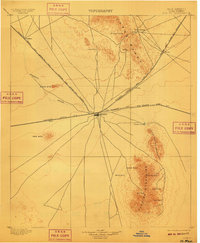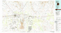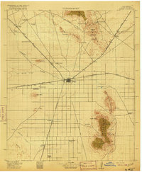
1915 Map of Deming
USGS Topo · Published 1915About this map
The junction of the Southern Pacific and the Atchison Topeka and Santa Fe railroads defines the high-desert hub of Deming during the early twentieth century. This survey reveals a landscape where modern transportation corridors began to overlie ancient paths, most notably where the Old Butterfield Trail cuts through the Pony Hills near the site of Fort Cummings. Settlement is sparse, characterized by family operations like the Jacobson Ranch and Birchfield Ranch that relied on intermittent water sources like the Mimbres River and Dyer Spring. Local education is anchored by remote rural institutions including Mountain View School and Red Mtn School, serving a population spread across the basin floor. Between the Florida Mountains and Red Mtn., the map preserves the precise locations of now-obscure sidings and stops such as Parma, Tunis, and Luxor that once supported the regional ranching economy.
Find a feature on this map
57 named features on this map. Tap any name to fly to it.
Don’t see what you’re looking for? This feature index may not catch every label — zoom into the map to look around manually.
Map Details
Editions of this 1915 Deming Map
4 editions found