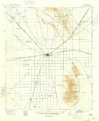
1915 Map of Deming
USGS Topo · Published 1948About this map
The railroad hub of Deming serves as the central focal point of this southwestern landscape, where the Southern Pacific and the Atchison Topeka and Santa Fe lines intersect. This 1915 revision captures a critical era of transition in Luna County, showing the proximity of early military history at Fort Cummings to the emerging agricultural and ranching infrastructure. The arid terrain is defined by the Florida Mountains and the seasonal path of the Mimbres River, which disappears into the desert floor. Rural education is established through scattered institutions like Red Mtn School and Mountain View School, while the historic Old Butterfield Trail remains a visible scar across the northern hills, marking the path of earlier transcontinental travel before the dominance of the steam engine.
Find a feature on this map
59 named features on this map. Tap any name to fly to it.
Don’t see what you’re looking for? This feature index may not catch every label — zoom into the map to look around manually.
Map Details
Editions of this 1915 Deming Map
4 editions found
Other maps of this area

1899 · Deming
USGS Topo · 1:125,000

1909 · Silver City
USGS Topo · 1:125,000

1915 · Deming
USGS Topo · 1:125,000

1917 · Hermanas
USGS Topo · 1:62,500

1917 · Camel Mountain
USGS Topo · 1:62,500

1917 · Columbus
USGS Topo · 1:62,500

1918 · Columbus
USGS Topo · 1:62,500

1918 · Hermanas
USGS Topo · 1:62,500

1918 · Victorio
USGS Topo · 1:62,500

1920 · Columbus
USGS Topo · 1:62,500