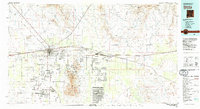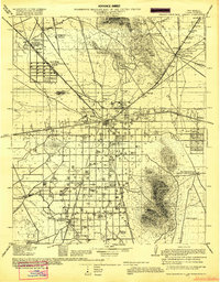
1915 Map of Deming
USGS Topo · Published 1919About this map
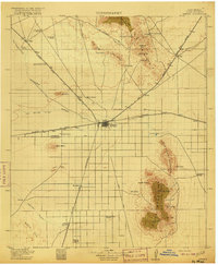
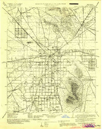
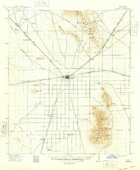
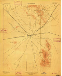
Fort Cummings stands as a sentinel in the northeast corner of this 1915 military survey, overlooking a desert landscape defined by the convergence of major southwestern railroads. The town of Deming serves as a critical junction for the Atchison Topeka and Santa Fe, Southern Pacific, and El Paso and Southwestern lines. This era of early 20th-century development is marked by sprawling ranching operations like the Birchfield Ranch and localized industry at the Bradley Mine. The presence of the Butterfield Trail cutting across the northern terrain provides a window into older westward migration routes that preceded the rail network. Small rural centers such as Hondale and the Iola P.O. illustrate the scattered settlement pattern, supported by isolated schools like Mountain View School and the agricultural efforts of the Spalding Tract north of the Mimbres River.
Find a feature on this map
70 named features on this map. Tap any name to fly to it.
Don’t see what you’re looking for? This feature index may not catch every label — zoom into the map to look around manually.
Map Details
Editions of this 1915 Deming Map
4 editions found