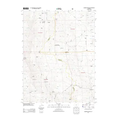
2013 Map of Cameron Mountain
USGS Topo · Published 2013About this map
Turret and Whitehorn anchor this high-elevation landscape within the San Isabel National Forest, where the complex borders of Chaffee, Park, and Fremont Counties converge. The area is defined by sharp elevation changes, ranging from the heights of Cameron Mountain and Green Mountain to the deep incisions of Railroad Gulch and Stafford Gulch. The settlement pattern reflects a history of specialized land use, notably the Oklahoma State University Engineering Camp and the scattered Fires Ranch.
Find a feature on this map
67 named features on this map. Tap any name to fly to it.
Don’t see what you’re looking for? This feature index may not catch every label — zoom into the map to look around manually.
Map Details
Editions of this 2013 Cameron Mountain Map
This is the sole edition of this map. No revisions or reprints were ever made.
Other maps of this area

1954 · Pueblo
USGS Topo · 1:250,000

1955 · Buena Vista
USGS Topo · 1:62,500

1956 · Cameron Mountain
USGS Topo · 1:62,500

1956 · Poncha Springs
USGS Topo · 1:62,500

1956 · Montrose
USGS Topo · 1:250,000

1957 · Pueblo
USGS Topo · 1:250,000

1958 · Pueblo
USGS Topo · 1:250,000

1959 · Montrose
USGS Topo · 1:250,000

1959 · Antero Reservoir
USGS Topo · 1:62,500

1960 · Montrose
USGS Topo · 1:250,000