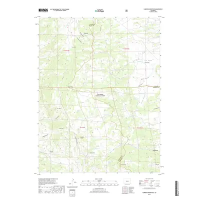
2019 Map of Cameron Mountain
USGS Topo · Published 2019About this map
Turret and Whitehorn anchor the southern reaches of this landscape, marking historical nodes of settlement where Chaffee, Fremont, and Park Counties converge. The terrain is defined by a series of prominent peaks and ridgelines, including Cameron Mtn and Calumet Mtn, which overlook a network of hydrologic features like Manoa Springs and School Section Spring. The mapping of Graphite Ridge and Marble Quarry Gulch points to the specific mineral interests that once drew prospectors and laborers to these high elevations.
Find a feature on this map
57 named features on this map. Tap any name to fly to it.
Don’t see what you’re looking for? This feature index may not catch every label — zoom into the map to look around manually.
Map Details
Editions of this 2019 Cameron Mountain Map
This is the sole edition of this map. No revisions or reprints were ever made.
Other maps of this area

1954 · Pueblo
USGS Topo · 1:250,000

1955 · Buena Vista
USGS Topo · 1:62,500

1956 · Cameron Mountain
USGS Topo · 1:62,500

1956 · Poncha Springs
USGS Topo · 1:62,500

1956 · Montrose
USGS Topo · 1:250,000

1957 · Pueblo
USGS Topo · 1:250,000

1958 · Pueblo
USGS Topo · 1:250,000

1959 · Montrose
USGS Topo · 1:250,000

1959 · Antero Reservoir
USGS Topo · 1:62,500

1960 · Montrose
USGS Topo · 1:250,000