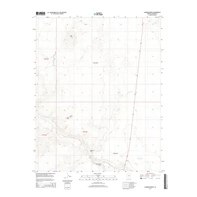
2014 Map of Cameron North
USGS Topo · Published 2014About this map
Cameron serves as a central hub in this high-desert landscape where the Little Colorado River carves a winding path through the arid Coconino County terrain. The river is joined by seasonal drainages such as Moenkopi Wash and Tappan Wash, highlighting a complex hydrologic network essential to this region. Prominent volcanic features like Shadow Mtn and Black Knob rise above the surrounding plateaus, providing distinct navigational landmarks. The map details the intersection of Us-89 and Bia-6730, illustrating the modern transportation corridors that follow traditional routes through the Painted Desert. From the depths of Tappan Spring Canyon to isolated water sources like Tank Number Thirteen, the survey captures the sparse but vital infrastructure of the Navajo Nation boundary lands.
Find a feature on this map
15 named features on this map. Tap any name to fly to it.
Don’t see what you’re looking for? This feature index may not catch every label — zoom into the map to look around manually.
Map Details
Editions of this 2014 Cameron North Map
This is the sole edition of this map. No revisions or reprints were ever made.
Other maps of this area

1886 · San Francisco Mtns
USGS Topo · 1:250,000

1886 · Echo Cliffs
USGS Topo · 1:250,000

1891 · San Francisco Mtns
USGS Topo · 1:250,000

1891 · Echo Cliffs
USGS Topo · 1:250,000

1894 · San Francisco Mtns
USGS Topo · 1:250,000

1899 · San Francisco Mtns
USGS Topo · 1:250,000

1947 · Flagstaff
USGS Topo · 1:250,000

1954 · Flagstaff
USGS Topo · 1:250,000

1955 · Coconino Pt SE
USGS Topo · 1:24,000

1955 · Coconino Pt NE
USGS Topo · 1:24,000