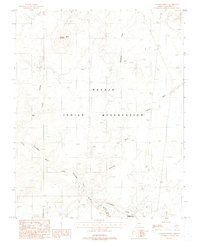
1988 Map of Cameron North
USGS Topo · Published 1988About this map
The Little Colorado River carves a deep path across this high desert landscape, defining the topography of the Navajo Indian Reservation during the late 1980s. To the northwest, the prominent volcanic profile of Shadow Mountain rises above the surrounding flats, adjacent to several Cinder Pits and industrial Quarries. Human presence in this arid reach is marked by the small settlement of Cameron in the south, located near where the river enters the winding Tappan Wash Canyon. Infrastructure is sparse but critical, evidenced by a Landing Strip and a Pipeline traversing the terrain, while the historic Hopi Canyon Trail provides a overland route through the drainage system of Hopi Canyon. Seasonal watercourses like Moenkopi Wash and Fivemile Wash dissect the plateaus, illustrating the drainage patterns that have shaped this portion of Coconino County.
Find a feature on this map
18 named features on this map. Tap any name to fly to it.
Don’t see what you’re looking for? This feature index may not catch every label — zoom into the map to look around manually.
Map Details
Editions of this 1988 Cameron North Map
This is the sole edition of this map. No revisions or reprints were ever made.
Other maps of this area

1886 · San Francisco Mtns
USGS Topo · 1:250,000

1886 · Echo Cliffs
USGS Topo · 1:250,000

1891 · San Francisco Mtns
USGS Topo · 1:250,000

1891 · Echo Cliffs
USGS Topo · 1:250,000

1894 · San Francisco Mtns
USGS Topo · 1:250,000

1899 · San Francisco Mtns
USGS Topo · 1:250,000

1947 · Flagstaff
USGS Topo · 1:250,000

1954 · Flagstaff
USGS Topo · 1:250,000

1955 · Coconino Pt SE
USGS Topo · 1:24,000

1955 · Coconino Pt NE
USGS Topo · 1:24,000