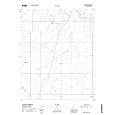
2018 Map of Cameron South
USGS Topo · Published 2018About this map
Cameron serves as the primary focal point on this landscape, situated near the northern edge where the High Desert terrain is dramatically carved by the Little Colorado River Gorge. The map documents a complex network of transportation and utility routes, including the Black Mesa Pump Station Rd and the historical alignment of Old US Hwy 89. These roads traverse an arid environment defined by seasonal drainages like Tappan Wash and Burro Canyon Wash. Natural water sources such as Tappan Spring, located within Tappan Spring Canyon, and Janus Spring suggest the critical importance of reliable water in this Coconino County region. The surveying of township and range lines across this area illustrates the systematic division of land in northern Arizona, providing a clear view of the infrastructure supporting both modern utility needs and local transit near the river.
Find a feature on this map
21 named features on this map. Tap any name to fly to it.
Don’t see what you’re looking for? This feature index may not catch every label — zoom into the map to look around manually.
Map Details
Editions of this 2018 Cameron South Map
This is the sole edition of this map. No revisions or reprints were ever made.
Other maps of this area

1886 · San Francisco Mtns
USGS Topo · 1:250,000

1891 · San Francisco Mtns
USGS Topo · 1:250,000

1894 · San Francisco Mtns
USGS Topo · 1:250,000

1899 · San Francisco Mtns
USGS Topo · 1:250,000

1947 · Flagstaff
USGS Topo · 1:250,000

1954 · Flagstaff
USGS Topo · 1:250,000

1955 · Black Falls NE
USGS Topo · 1:24,000

1955 · Coconino Pt SE
USGS Topo · 1:24,000

1955 · Coconino Pt NE
USGS Topo · 1:24,000

1955 · Cameron SW
USGS Topo · 1:24,000