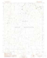
1988 Map of Cameron South
USGS Topo · Published 1988About this map
The Little Colorado River defines the northeastern corner of this high-desert landscape, where the historic Tanners Crossing indicates a significant point of river passage in the arid plateau. Set within the Navajo Indian Reservation during the late 1980s, the map reveals the critical infrastructure supporting this environment, including a pumping station, a substation, and several sewage disposal ponds near Cameron. Natural water sources remain vital landmarks, noted by the presence of Tappan Spring and Janus Spring along the edges of Tappan Wash and Burro Canyon. Human activity is concentrated along Highway 89, where a trailer park and a local gravel pit sit near the river's edge, reflecting the region's modest industrial and residential footprint at the time of the survey.
Find a feature on this map
22 named features on this map. Tap any name to fly to it.
Don’t see what you’re looking for? This feature index may not catch every label — zoom into the map to look around manually.
Map Details
Editions of this 1988 Cameron South Map
This is the sole edition of this map. No revisions or reprints were ever made.
Other maps of this area

1886 · San Francisco Mtns
USGS Topo · 1:250,000

1891 · San Francisco Mtns
USGS Topo · 1:250,000

1894 · San Francisco Mtns
USGS Topo · 1:250,000

1899 · San Francisco Mtns
USGS Topo · 1:250,000

1947 · Flagstaff
USGS Topo · 1:250,000

1954 · Flagstaff
USGS Topo · 1:250,000

1955 · Black Falls NE
USGS Topo · 1:24,000

1955 · Coconino Pt SE
USGS Topo · 1:24,000

1955 · Coconino Pt NE
USGS Topo · 1:24,000

1955 · Cameron SW
USGS Topo · 1:24,000