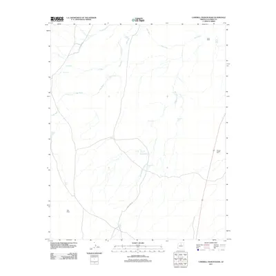
2011 Map of Campbell Francis Wash
USGS Topo · Published 2011About this map
The Wauneta Trading Post stands as a focal point in this high-desert landscape, situated along the eastern edge of a region defined by ephemeral watercourses. This arid territory in Coconino County is intricately carved by the Campbell Francis Wash, Needmore Wash, and Cedar Wash, which drain the volcanic topography near Lava Point. The distribution of man-made water catchments, or tanks, reveals the essential infrastructure for ranching and survival in this environment. Named features such as Eugene Gordy Tank, Large Whiskers Tank, and Lockett Tank suggest a history of local land use and grazing rights, where every reliable water source was a critical landmark for travelers and residents alike.
Find a feature on this map
22 named features on this map. Tap any name to fly to it.
Don’t see what you’re looking for? This feature index may not catch every label — zoom into the map to look around manually.
Map Details
Editions of this 2011 Campbell Francis Wash Map
This is the sole edition of this map. No revisions or reprints were ever made.
Other maps of this area

1886 · San Francisco Mtns
USGS Topo · 1:250,000

1891 · San Francisco Mtns
USGS Topo · 1:250,000

1894 · San Francisco Mtns
USGS Topo · 1:250,000

1899 · San Francisco Mtns
USGS Topo · 1:250,000

1947 · Flagstaff
USGS Topo · 1:250,000

1954 · Flagstaff
USGS Topo · 1:250,000

1955 · Coconino Pt SE
USGS Topo · 1:24,000

1955 · Cameron SW
USGS Topo · 1:24,000

1955 · Cameron
USGS Topo · 1:62,500

1958 · Flagstaff
USGS Topo · 1:250,000