
1955 Map of Cameron
USGS Topo · Published 1959About this map
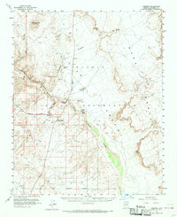
Buck Rodgers Trading Post stands as a focal point of commerce and navigation within the Navajo Indian Reservation during the mid-1950s. The settlement of Cameron marks a critical junction where the Little Colorado River begins its dramatic descent into the Little Colorado River Gorge. The map illustrates a landscape defined by seasonal watercourses like Moenkopi Wash and Fivemile Wash, alongside the expansive eastern reaches of the Painted Desert.
Find a feature on this map
26 named features on this map. Tap any name to fly to it.
Don’t see what you’re looking for? This feature index may not catch every label — zoom into the map to look around manually.
Map Details
Editions of this 1955 Cameron Map
2 editions found
Other maps of this area

1886 · San Francisco Mtns
USGS Topo · 1:250,000

1886 · Echo Cliffs
USGS Topo · 1:250,000

1891 · San Francisco Mtns
USGS Topo · 1:250,000

1891 · Echo Cliffs
USGS Topo · 1:250,000

1894 · San Francisco Mtns
USGS Topo · 1:250,000

1899 · San Francisco Mtns
USGS Topo · 1:250,000

1947 · Flagstaff
USGS Topo · 1:250,000

1954 · Flagstaff
USGS Topo · 1:250,000

1955 · Black Falls NE
USGS Topo · 1:24,000

1955 · Coconino Pt SE
USGS Topo · 1:24,000