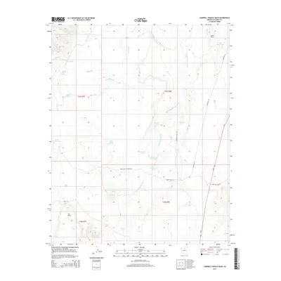
2014 Map of Campbell Francis Wash
USGS Topo · Published 2014About this map
Lava Point and the high desert terrain of Coconino County define this arid landscape, where water management is the primary marker of human presence. The area is characterized by a complex network of drainage systems including Lava Wash, Needmore Wash, and the namesake Campbell Francis Wash. This 2014 survey documents a ranching environment dependent on numerous catchments and tanks, such as Keetso Tank, Bull Pasture Tank, and the uniquely named Large Whiskers Tank. Transportation is concentrated along the eastern corridor with Us-89 providing the main north-south artery, while internal access is maintained via desert tracks like Babbit Ranch Rd and Spider Web Ranch Rd. The map provides a clear look at the intersection of public land divisions, including t27n r8e and t26n r7e, reflecting the enduring grid of the American West.
Find a feature on this map
31 named features on this map. Tap any name to fly to it.
Don’t see what you’re looking for? This feature index may not catch every label — zoom into the map to look around manually.
Map Details
Editions of this 2014 Campbell Francis Wash Map
This is the sole edition of this map. No revisions or reprints were ever made.
Other maps of this area

1886 · San Francisco Mtns
USGS Topo · 1:250,000

1891 · San Francisco Mtns
USGS Topo · 1:250,000

1894 · San Francisco Mtns
USGS Topo · 1:250,000

1899 · San Francisco Mtns
USGS Topo · 1:250,000

1947 · Flagstaff
USGS Topo · 1:250,000

1954 · Flagstaff
USGS Topo · 1:250,000

1955 · Coconino Pt SE
USGS Topo · 1:24,000

1955 · Cameron SW
USGS Topo · 1:24,000

1955 · Cameron
USGS Topo · 1:62,500

1958 · Flagstaff
USGS Topo · 1:250,000