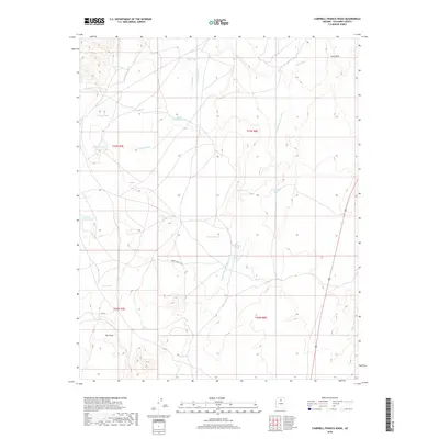
2018 Map of Campbell Francis Wash
USGS Topo · Published 2018About this map
Lava Point and The Point anchor this arid landscape within Coconino County, defined by a network of seasonal drainage and cattle tanks. The terrain is dominated by high-plateau hydrology, where Needmore Wash, Lava Wash, and Cedar Wash converge toward the primary Campbell Francis Wash. This 2018 survey reveals the infrastructure of modern ranching in the American Southwest, centered on the Babbit Ranch Rd corridor. Named water catchments such as Large Whiskers Tank, Eugene Gordy Tank, and Wheelbarrow Tank are scattered across the township grids, illustrating the vital importance of water management in this sparsely populated environment. The map provides a clear look at the intersection of natural volcanic landmarks and the human effort to sustain livestock in the high desert.
Find a feature on this map
25 named features on this map. Tap any name to fly to it.
Don’t see what you’re looking for? This feature index may not catch every label — zoom into the map to look around manually.
Map Details
Editions of this 2018 Campbell Francis Wash Map
This is the sole edition of this map. No revisions or reprints were ever made.
Other maps of this area

1886 · San Francisco Mtns
USGS Topo · 1:250,000

1891 · San Francisco Mtns
USGS Topo · 1:250,000

1894 · San Francisco Mtns
USGS Topo · 1:250,000

1899 · San Francisco Mtns
USGS Topo · 1:250,000

1947 · Flagstaff
USGS Topo · 1:250,000

1954 · Flagstaff
USGS Topo · 1:250,000

1955 · Coconino Pt SE
USGS Topo · 1:24,000

1955 · Cameron SW
USGS Topo · 1:24,000

1955 · Cameron
USGS Topo · 1:62,500

1958 · Flagstaff
USGS Topo · 1:250,000